Geoclimate Logo
  • People involved
  • Introduction
  • Installation
  • Processing steps

Data

  • Input data
    • Zone layer
    • Building layer
    • Road Layer
    • Railway Layer
    • Vegetation Layer
    • Water Layer
    • Impervious Layer
    • Urban Areas Layer
    • Sea Land Areas Layer
  • Output data
    • Building Indicators
    • Block Indicators
    • RSU indicators
    • LCZ Classification
    • UTRF classification
    • Road Indicators
    • Ground Acoustic
    • Grid indicators
    • Sprawl areas

Show

  • Display Output with QGIS
  • View Data with DBeaver

Linux

  • Default case with OSM
  • Default case with BDTopo
  • Bounding box case
  • Create WRF inputs from LCZ
  • Create WRF inputs

Windows

  • Default case with OSM
  • Default case with BDTopo
  • Bounding box case
  • Create WRF inputs from LCZ
  • Create WRF inputs

Other

  • Frequently asked questions
  • Gallery
  • Download
  • Integrate Geoclimate in your lib
  • Coding implementation
  • References
Geoclimate
  • Gallery
  • Edit on GitHub

Gallery

Local Climate Zones

_images/lcz_angers.png _images/reading_rsu_lcz.png

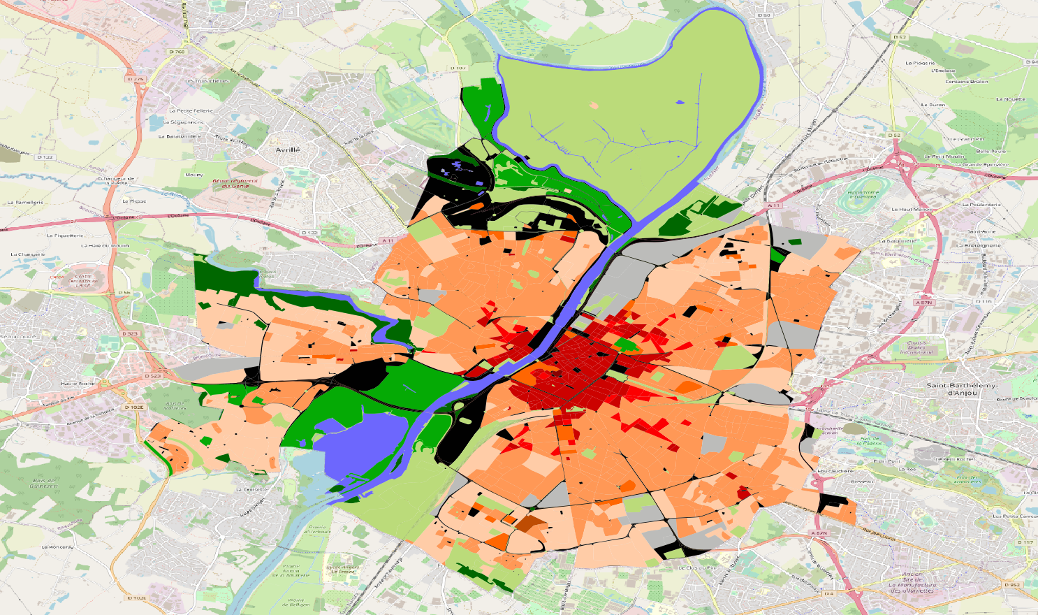
Angers city - FR (EPSG 4326)

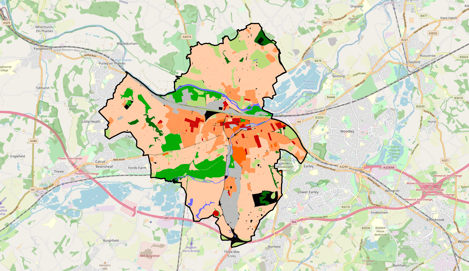
Reading city - UK (EPSG 3857)

_images/lcz_utrecht.png _images/lcz_washington.png

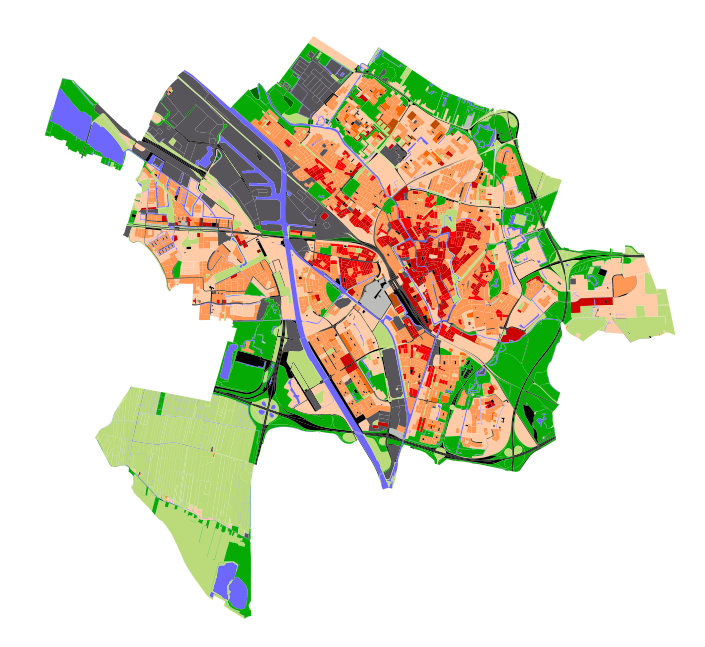
Utrecht city - NL (EPSG 3857)

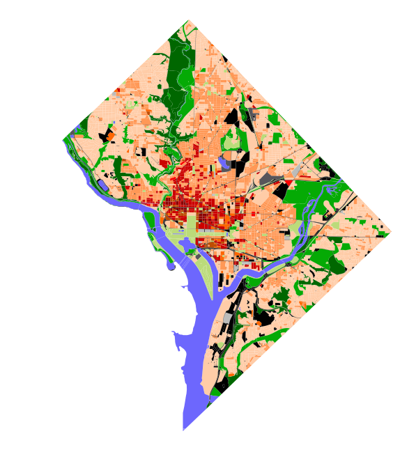
Washington D.C - USA (EPSG 3857)
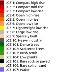
Legend

_images/lcz_legend_angers.png

Fractions at grid scale

Topographic feature fractions on a 10 x 10 km domain and 1 x 1 km square cell for the city of Angers.

_images/fraction_angers.png

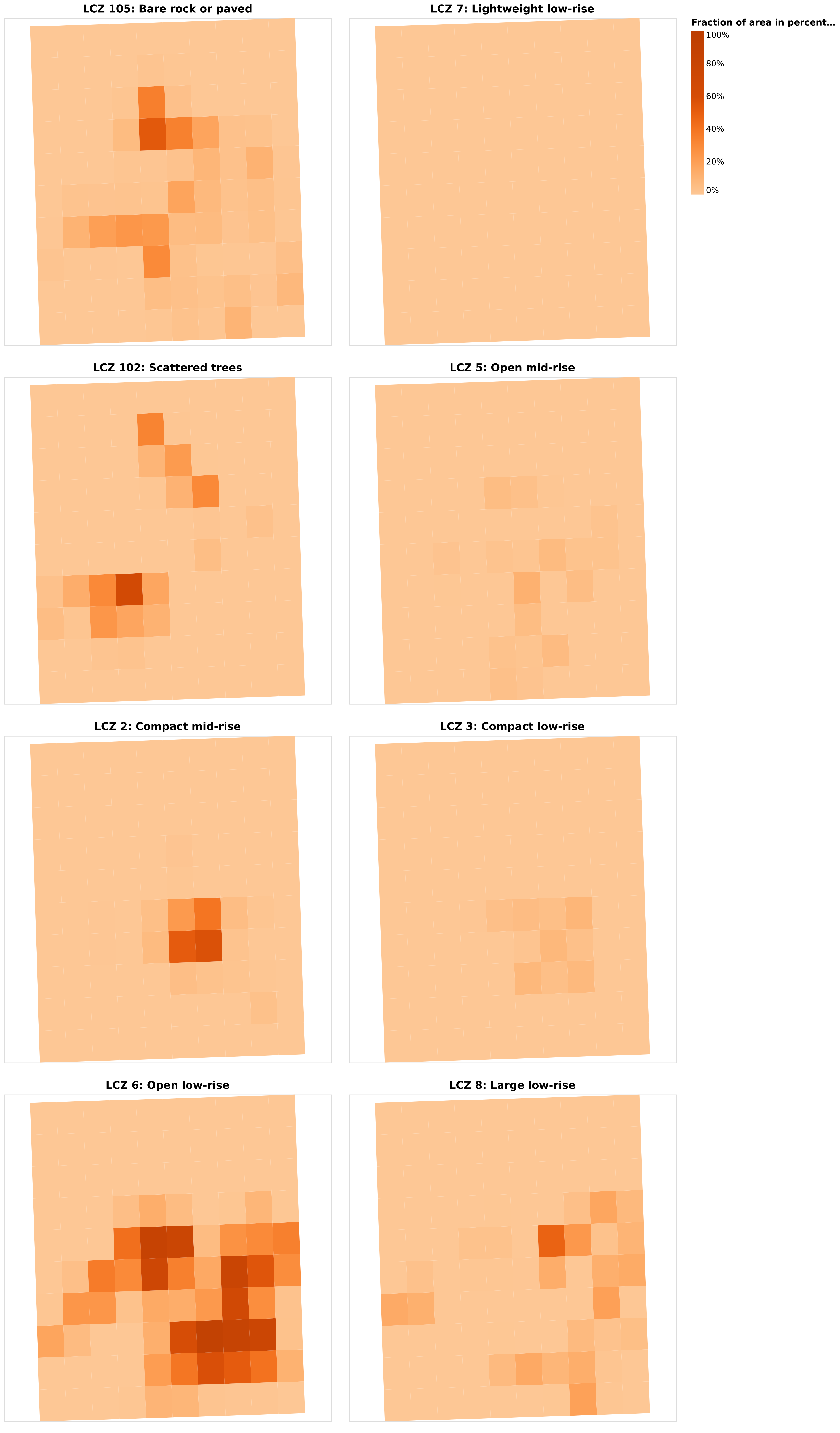
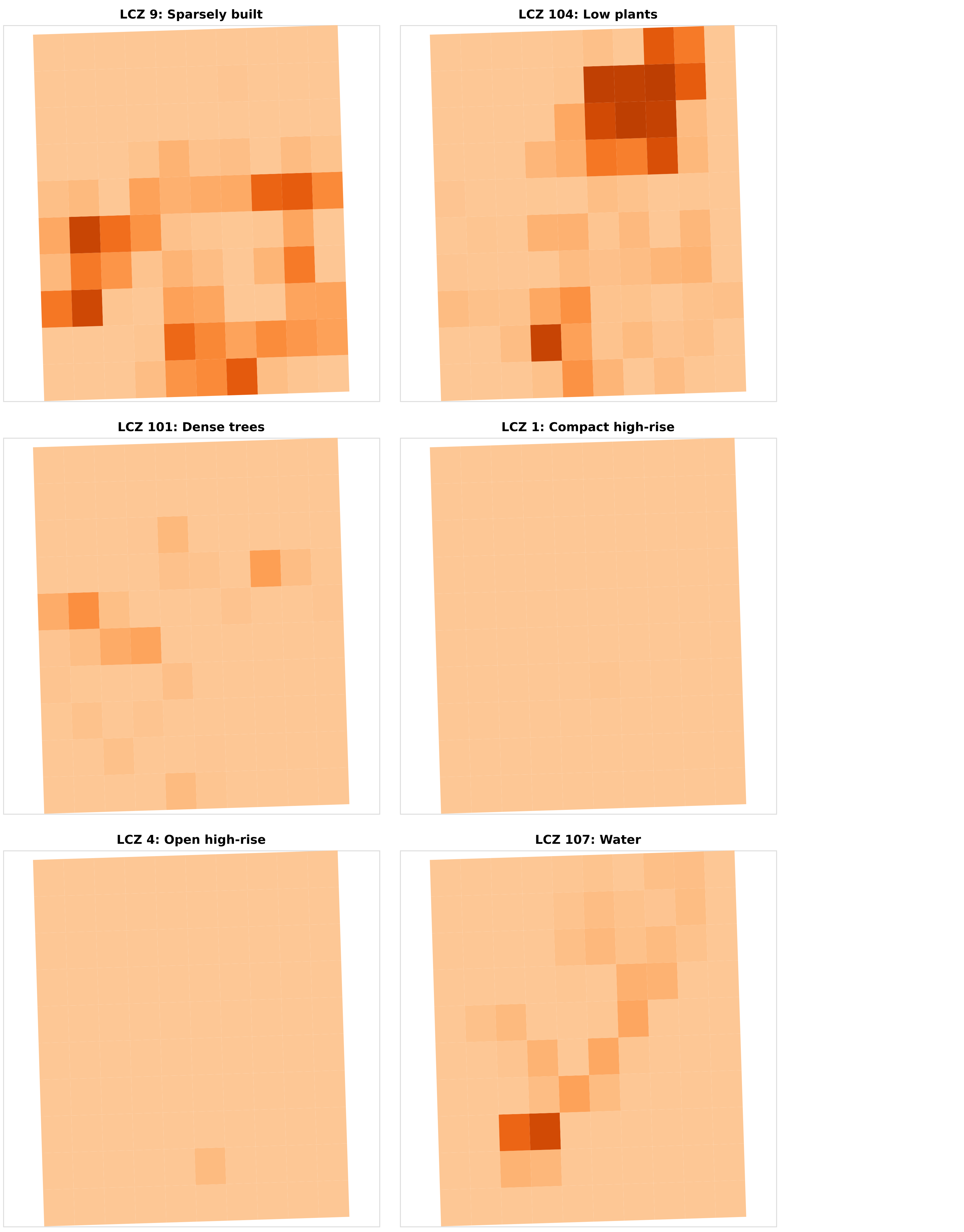
Local Climate zone fractions on a 10 x 10 km domain and 1 x 1 km square cell for the city of Angers.

_images/lcz_fractions_angers_1_8.png _images/lcz_fractions_angers_8_100.png

Urban typologies

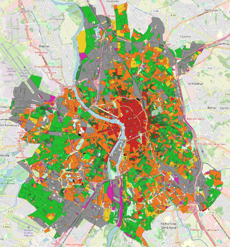
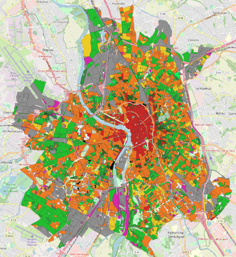
Toulouse city - FR (EPSG 3857)

With building area indicator

With building floor area indicator

Legend

_images/toulouse_urban_typo_area_rsu.png _images/toulouse_urban_typo_floor_area_rsu.png _images/urban_typo_legend.png

/home/mael/Documents/forks/geoclimate/docs/source/Gallery.rst:38: ERROR: Error in “image” directive: invalid option value: (option: “height”; value: ‘300px ‘) not a positive measure of one of the following units: “em” “ex” “px” “in” “cm” “mm” “pt” “pc” “”.

_images/fraction_angers.png

/home/mael/Documents/forks/geoclimate/docs/source/Gallery.rst:45: ERROR: Error in “image” directive: invalid option value: (option: “height”; value: ‘300px ‘) not a positive measure of one of the following units: “em” “ex” “px” “in” “cm” “mm” “pt” “pc” “”.

_images/lcz_fractions_angers_1_8.png

GeoClimate - documentation 2020 - 2025 - Creative Commons License This work is licensed under a Creative Commons Attribution-ShareAlike 4.0 International License.

Previous Next

© Copyright 2025, CNRS-Lab-STICC.

Built with Sphinx using a theme provided by Read the Docs.